
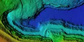
ArcGIS is a suite of tools for creating, mapping, visualising, and analysing spatial data at a variety of scales. It is used around the world for analysing data in geographic context and has applications including urban planning, land use and management, resource management, site selection, and logistics.
Quintessa uses ArcGIS to support clients in decision-making. ArcGIS can be used during the evaluation of options for site monitoring systems. Maps illustrating infrastructure constraints, such as buildings and drainage systems for on-shore sites or offshore wind farms, on monitoring locations provide insight to support siting decisions. The location priorities of stakeholders can be captured live for easy visualisation. 3D visualisations show how existing infrastructure interacts with the subsurface geology.
Quintessa can use geospatial techniques to support the parameterisation of safety case assessment models for radioactive waste disposal facilities. GIS can help support the development of models required to represent potential pathways for release of radioactive contaminants to groundwater, and eventually human and wildlife receptors, over thousands of years.