
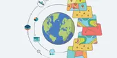
 Geographic Information Systems (GIS) provide users of the subsurface effective ways to visualise and analyse data on maps. Quintessa uses GIS to support clients to make informed decisions using their data by adding geographic context to projects and performing geospatial analysis to improve site selection, monitoring or risk analysis projects. The 3D capabilities of GIS are used to link surface infrastructure to the geography and geology of the surrounding environment.
Quintessa has skilled users of ESRI’s ArcGIS platform of software, including ArcMap, ArcGIS Pro and ArcGIS Online. ArcGIS provides mapping, analytic and data management capabilities for working with geospatial data and imagery. Our skills include the following.
Cartography and Visualisation
Cartography is fundamental for communicating and visualising geospatial data and relationships. Quintessa uses ArcGIS Pro to generate quality maps to communicate data, ideas and solutions. Maps can highlight modelling concepts by linking them to real world geographical features or designated protection zones. 2D visualisations can map concepts such as monitoring requirements whilst accounting for constraints from infrastructure and environment. 3D GIS models can show links between surface infrastructure and the deep geological system, for example highlighting potential leakage pathways from underground storage or disposal facilities through transmissive geological layers or faults, and highlighting areas with increased requirements for monitoring. Cartography and visualisation support Quintessa’s data-to-decisions approach and are valuable tools in options assessment, particularly when assessing monitoring options for projects with strong constraints on the space available.
Spatial data science
Data science projects can be enhanced by the inclusion of spatial data such as population or building density and proximity to geographic or geological features. Data science methodologies can account for unknown spatial variations in continuous or discrete data sets or support data analysis by providing geographic context. For example, interpolation of precipitation data can be enhanced by including topography in the interpolation, given its known influence on precipitation. Quintessa has experience using spatial data science methods to understand sparse data sets and their geographic relationships, enhancing data with complementary public domain data and analysing satellite data and imagery with machine learning techniques.
Data management
Good data management is key to for GIS projects; Quintessa is experienced using ESRI standard data formats as well as a variety of other supported formats to create and maintain geospatial databases. Data attribution allows users to interrogate and analyse the data most effectively, particularly for spatial data science projects.